- Trips
- Lighthouse Tours
- Bug Light - Long Beach Bar Orient
- Cedar Island Lighthouse
- Horton Point Lighthouse
- Latimer Lighhouse
- Little Gull Lighthouse
- North Dumpling Lighthouse
- Orient Point Lighthouse
- Plum Island Lighthouse
- Race Rock Lighthouse
- South East Lighthouse
- Block Island North Lighthouse

Cedar Island Lighthouse
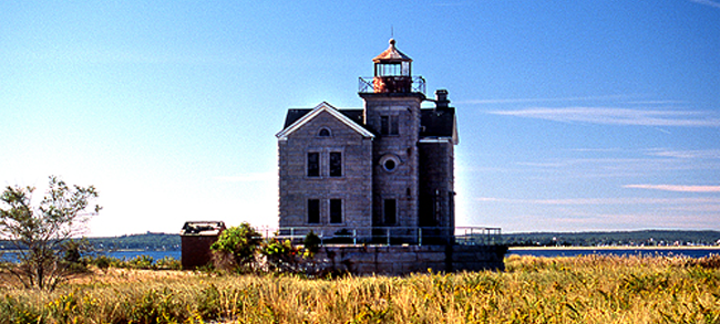 Settled in 1651, Cedar Point was once a busy port for shipping farm goods, fish, and timber from Sag Harbor. The historic Cedar Point Lighthouse stood on an island 200 yards from shore when it was built in 1839. Its beacon served to guide whaling ships in and out of Sag Harbor during its hey-day as a major port. The New England Hurricane of 1938 transformed the shoreline, shifting sands to create a narrow, walkable strip that now connects the lighthouse with the mainland. Cedar Island Lighthouse on Wikipedia
Coordinates:
41°2'26.9"N
72°15'39.5"W
41.040806°N
72.260972°W
Year first lit: 1839
Automated: 1934
Deactivated: 1934
Foundation: Masonry pier
Construction: Granite
Tower shape: Square unpainted granite
Height: 40 ft
Focal Height: 57 ft (17 m)
Original lens: Sixth order Fresnel 1855
Range: 5nm
Characteristic: Fl G 4s - Flashing Green 4 s
ARLHS number: USA-147
« Return to lighthouse list